Maximizing Yields: Aerial Data for Smart Farming

In the ever-evolving world of agriculture, farmers are constantly seeking innovative ways to enhance productivity and efficiency. One of the most promising advancements in this field is the use of aerial data. By leveraging drone technology and satellite imagery, farmers can gain valuable insights into their crops, leading to smarter farming decisions. This blog post explores how aerial data can maximize yields and transform traditional farming practices.

Understanding Aerial Data
Aerial data refers to information collected from above the ground using various technologies, primarily drones and satellites. This data can include high-resolution images, thermal readings, and multispectral data, which provide insights into crop health, soil conditions, and overall farm management.
Types of Aerial Data
Imagery: High-resolution images captured by drones or satellites can reveal detailed information about crop conditions, pest infestations, and nutrient deficiencies.
Thermal Data: This data helps farmers identify temperature variations in their fields, which can indicate irrigation needs or plant stress.
Multispectral Data: By capturing data across different wavelengths, multispectral sensors can assess plant health and detect issues that are not visible to the naked eye.
Benefits of Using Aerial Data in Farming
The integration of aerial data into farming practices offers numerous benefits, including:
Improved Crop Monitoring
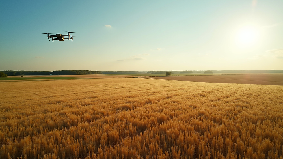
Farmers can monitor their crops more effectively with aerial data. Drones equipped with cameras can cover large areas quickly, allowing farmers to identify problems early. For instance, a farmer can spot areas of a field that are not thriving and take corrective action before the issue spreads.
Precision Agriculture
Aerial data supports precision agriculture, which involves tailoring farming practices to the specific needs of different areas within a field. By analyzing aerial images, farmers can apply fertilizers and pesticides only where needed, reducing waste and environmental impact.
Enhanced Decision-Making
With access to real-time data, farmers can make informed decisions about irrigation, planting, and harvesting. This data-driven approach leads to better resource management and increased yields.
Cost Efficiency
By optimizing inputs and reducing waste, aerial data can lead to significant cost savings. Farmers can lower their expenses on fertilizers, water, and labor while maximizing their crop output.
Implementing Aerial Data in Farming Practices
To effectively utilize aerial data, farmers should consider the following steps:
1. Choose the Right Technology
Selecting the appropriate drone or satellite service is crucial. Farmers should evaluate their specific needs, such as the size of their fields and the type of data required. Some popular drone models for agricultural use include the DJI Phantom 4 RTK and the Parrot Bluegrass.
2. Data Collection
Farmers should establish a routine for data collection. Regular flights over the fields can help track changes over time. It's essential to consider factors like weather conditions and the growth stages of crops when planning flights.
3. Data Analysis
Once data is collected, it must be analyzed to extract actionable insights. Farmers can use software tools like Pix4D or DroneDeploy to process aerial images and generate reports on crop health and soil conditions.
4. Take Action
The final step is to implement changes based on the data analysis. Whether it’s adjusting irrigation schedules or applying targeted treatments, taking action is crucial for maximizing yields.
Case Studies: Success Stories in Aerial Data Utilization
Case Study 1: Corn Production in Iowa
A farmer in Iowa utilized drone technology to monitor his cornfields. By analyzing aerial images, he identified areas with nutrient deficiencies. He applied fertilizers only to those specific areas, resulting in a 15% increase in yield compared to previous years.
Case Study 2: Vineyard Management in California
A vineyard owner in California employed aerial data to assess vine health. By using multispectral imaging, he detected water stress in certain sections of the vineyard. Adjusting irrigation practices based on this data led to improved grape quality and a 20% increase in wine production.
Challenges and Considerations
While aerial data presents numerous advantages, there are challenges to consider:
Data Privacy
Farmers must be aware of privacy concerns related to aerial data collection. Ensuring that data is used responsibly and ethically is essential.
Cost of Technology
The initial investment in drone technology and software can be significant. However, the long-term benefits often outweigh these costs.
Training and Expertise
Farmers may require training to effectively use aerial data. Investing in education and resources is crucial for maximizing the benefits of this technology.
The Future of Aerial Data in Agriculture
As technology continues to advance, the future of aerial data in agriculture looks promising. Innovations such as artificial intelligence and machine learning will enhance data analysis capabilities, allowing for even more precise farming practices. Additionally, the integration of aerial data with other technologies, such as IoT sensors, will provide a comprehensive view of farm health.
Conclusion
Aerial data is revolutionizing the way farmers approach crop management. By utilizing this technology, farmers can maximize yields, reduce costs, and make informed decisions that lead to sustainable farming practices. As the agricultural landscape continues to evolve, embracing aerial data will be essential for those looking to thrive in the industry.
The journey towards smarter farming starts with understanding and implementing aerial data. Farmers who invest in this technology today will reap the benefits of increased productivity and sustainability for years to come.

Comments